SATELLITE REMOTE SENSING IN AGRICULTURE

Minimum Order
1
Packaging
N/A
Delivery
15 Days
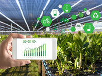
Satellite remote sensing in agriculture refers to the comprehensive technology of agricultural applications such as using agriculture satellite technology to investigate agricultural resources, analyzing land using status, monitoring agricultural pests and diseases, as well as estimating crop yields.

CONTENT OF AGRICULTURAL REMOTE SENSING SERVICE PRODUCT SYSTEM OF CGSTL
No. Product name Service frequency
1 Distribution of cultivated land resources and agricultural facilities Once a year
2 Crop planting structure monitoring Once/crop season
3 Crop growth monitoring Once/ten days
4 Farmland soil moisture and crop drought monitoring Once/ten days
5 Agricultural disaster monitoring On demand
6 Crop yield prediction Once/crop season

Chang Guang Satellite Technology Co., Ltd. is a satellite supplier, we provide agriculture satellite imagery, satellite imaging in agriculture, agriculture land images, agriculture satellite images, agriculture images, satellite imagery in agriculture, satellite in agriculture, agriculture satellite data, satellite communication service, etc. For more information, please feel free to contact us!
  • Country: China (Mainland)
  • Business Type:
  • Market:
  • Founded Year:2014
  • Address:No. 1299, Mingxi Road, Beihu Technological Development Zone, Changchun City, Jilin Province.
  • Contact:jl1global com
more images of SATELLITE REMOTE SENSING IN AGRICULTURE
*Your name:
*Your Email:
*To:Chang Guang Satellite Technology Co., Ltd.
*Subject:
*Message:
Enter between 20 to 3,000 characters. English only.     Characters : 0 / 3000
*Enter the secure code shown below Mfrbee security Image      Reload Image

submiting now We do inquire for you , please wait ...

INSURANCE SATELLITE REMOTE SENSING

Combining satellite remote sensing technologies with rights confirmation data and land parcel segmentation technology can vectorize and spatialize the subject matter of insurance, then establish a spatial database of the subject matter of insurance to provide spatial data and ...

Chang Guang Satellite Technology Co., Ltd.

GREENBELT SATELLITE REMOTE SENSING

grass remote sensing is a technology that is used to detect and analyze the type distribution and biomass of grassland resources. Changguang, as an excellent satellite company, offers a wide range of satellite for you to choose from. ...

Chang Guang Satellite Technology Co., Ltd.

REMOTE SENSING IN FORESTRY

Applications of remote sensing in forestry Remote sensing in forestry is a technology that uses the inherent characteristics of electromagnetic waves reflected or radiated by objects to identify objects and their environments by studying the characteristics of electromagnetic ...

Chang Guang Satellite Technology Co., Ltd.

REMOTE SENSING IN ENVIRONMENT

remote sensing in environment is a general term for monitoring, evaluating and forecasting the dynamic changes of the natural and social environment by using various remote sensing technologies. satellite environmental monitoring can quickly provide reliable basis for ...

Chang Guang Satellite Technology Co., Ltd.

Satellite Remote Sensing

Satellite Remote Sensing Remote sensing is a non-contact, long-distance detection technology. Relying on the unique global data set of JL1, using our big data intelligence tool to understand the changes taking place in the areas you are most concerned about, and help you make ...

Chang Guang Satellite Technology Co., Ltd.

INSURANCE SATELLITE REMOTE SENSING

Combining satellite and remote sensing technologies with rights confirmation data and land parcel segmentation technology can vectorize and spatialize the subject matter of insurance, then establish a spatial database of the subject matter of insurance to provide spatial data ...

Chang Guang Satellite Technology Co., Ltd.

Wifi/Ethernet 32 Gangs kc868h32B Smart Remote Controll pump water agriculture

PRODUCTS PARAMETER Dimension 272*117*40mm Material Fire resistance ABS、metal shell Working Voltage DC 12V Working Temp -20℃ ~70℃ Working Humidity 20%RH ~ 80%RH Output Load each 250V/10A Communication Mode Ethernet and WIFI 、RS232 Input Port qty 6 Ports Output Port qty ...

Hangzhou Kincony Electronics Co., Ltd.

Neon Remote Terminal (NRT) with Cellular or Satellite Transceiver

The Neon Remote Terminal (NRT) combines a data logger with either a duplex cellular or satellite transceiver. The NRT is designe ...

Geo Scientific Ltd

satellite dish - PM-2000 Carryout Portable-Remote Satellite Dish

PM-2000 Carryout Portable-Remote Satellite Dish ( WINPM2000 ) ...

Argonaut, Inc.